A reverse geocoding API converts latitude and longitude coordinates into a human-readable address. It powers nearest-store fallbacks, delivery confirmation screens, fleet dispatch notes, and any workflow where the system knows where a user or device is but needs to display a street, postcode, or place name. Most commercial APIs price per 1,000 lookups, with premium tiers for high-accuracy markets like the UK and Ireland.
Reverse geocoding vs geocoding: the direction matters
Forward geocoding takes a string ("221B Baker Street, London") and returns coordinates. Reverse geocoding does the opposite: it takes a coordinate pair like 51.5237, -0.1585 and returns a structured address - street number, route, locality, postcode, country. The two endpoints often share a billing line on a provider's price sheet, but they serve different workflows.
Forward geocoding tends to live in checkout, signup, and address-entry flows. Reverse geocoding lives in mobile apps that captured a GPS fix, in delivery driver tools that need to confirm the actual drop point, and in store locator pages that route a visitor to the nearest physical site without asking them to type anything.
A useful test: if your product holds a position and needs to show, log, or geocode-match it to something a human reads, you need reverse geocoding. If your product takes typed text and needs to plot it, you need forward geocoding. Many teams need both, and most APIs charge for each call regardless of direction.
Why decision-makers care: four business outcomes
Reverse geocoding is a small line item that touches large user journeys. Four outcomes typically justify the spend.
Conversion rate on mobile checkout. When a shopper opens a mobile commerce app and grants location permission, reverse geocoding can pre-fill the city and postcode in the shipping form. The friction reduction matters: industry research on form abandonment consistently points to address entry as a top three drop-off point on mobile.
Delivery accuracy and dispute reduction. Last-mile teams use reverse geocoding to convert a driver's GPS ping at delivery time into an address that matches (or fails to match) the customer's order. The mismatch flow - did the driver deliver to 12 rue de Rivoli or 12 boulevard de Rivoli - becomes a measurable dispute prevention metric, not a customer service guess.
Store locator UX. Users who click "find stores near me" expect coordinates to resolve into a neighborhood name, not just a list of pins. Reverse geocoding produces the "Stores near Camden Town, NW1" header that frames the result and helps the page rank for the location-named query.
Compliance audit trails. Logistics and B2B field service teams keep records of "where the event happened" for SLA, insurance, and dispute purposes. A coordinate alone is opaque; a structured address tied to the coordinate is auditable. For EU operators, the address layer is also where data residency questions surface.
How reverse geocoding actually works
Behind the API call, a reverse geocoder runs four steps:
- Snap the point to a road network or building footprint. A coordinate floating in the middle of a block needs to attach to something - a street centerline, a parcel polygon, or a building entrance.
- Score candidate features by distance and confidence. Providers vary in how they break ties between, say, a side-street and a main road at an intersection.
- Resolve administrative hierarchy. Locality, region, postal code, and country come from a separate index. Boundary edge cases are where providers diverge.
- Format the result. Different markets expect different address formats (US house-number-first, French street-number-then-name, UK postcode position). A good API respects local convention.
The interesting engineering question is precision: a coordinate at GPS accuracy (5 to 10 meters open sky, 20 to 50 meters in dense urban) lands inside a building or on a sidewalk, not on a labeled street point. ROOFTOP-level results - returning the actual building entrance the coordinate falls inside - require a denser dataset than centerline approximation. This is the dataset axis on which providers differ most, and it is the axis most worth scrutinizing before you commit.
What to evaluate when choosing a provider
The provider grid is wider than the three vendors most teams shortlist by default. Five evaluation axes matter more than feature checklists.
1. Data residency and TOS
Where does the request land, and what can you do with the response? Google Maps Platform terms of service restrict caching, retention, and downstream use of geocoding results, and they prohibit displaying Google-derived geocoding results on a non-Google map. Mapbox and a number of European providers have less restrictive caching rules. For EU operators, the residency question is downstream of GDPR Article 44 on transfers of personal data outside the EU - IP addresses sent to a US-routed API are personal data under recent EU rulings, which makes the provider routing diagram a compliance artifact.
2. Coverage and accuracy by market
A provider that performs well in the US can be uneven in the UK, where address quality depends on Royal Mail PAF licensing, or in Ireland, where the Eircode dataset is the canonical source. UK and IE reverse geocoding is frequently a separate premium tier on commercial APIs precisely because the licensed datasets cost more. Test your top three markets with real coordinates from your traffic, not with a vendor's curated demo set.
3. Pricing model and predictability
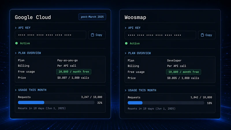
Per-1,000-call pricing looks straightforward until you discover keystroke billing (every autocomplete suggestion charged), session token rules, or minimum monthly commits. Reverse geocoding is usually a flat per-call line, but read the price sheet for the volume tiers. For example, on the Woosmap price sheet, the Localities Geocode line (which covers reverse geocoding) is $0.00 for the first 10,000 calls per month, then $2.04 per 1,000 up to 100,000, $1.64 per 1,000 up to 500,000, and $1.53 per 1,000 beyond. UK premium reverse geocoding is a separate, much higher line that reflects the underlying dataset license cost.
4. SLA and operational fit
Latency targets matter when reverse geocoding sits inside a synchronous user flow (locator, checkout). For batch workflows (overnight import of delivery records), throughput and rate-limit behavior matter more than P50 latency. Check the SLA percentage written into the contract, not the marketing page number.
5. Lock-in cost
The hidden cost is the migration cost when you outgrow the first provider. Some providers ship SDKs and field-naming conventions that match a major incumbent, which lowers swap cost. Others use proprietary response shapes that require a translation layer in your codebase. The lock-in cost is rarely a Day 1 selection criterion, but it should be a Day 30 one.