📅 Free webinar · 14 October, 11-11.30am BST (UK time)Will AI recommend your stores? Three moments that decide a saleSave your seat
Location Intelligence Service: What It Is and How to Choose
Jean-Thomas Rouzin - Reading time : 11 min
Table of contents
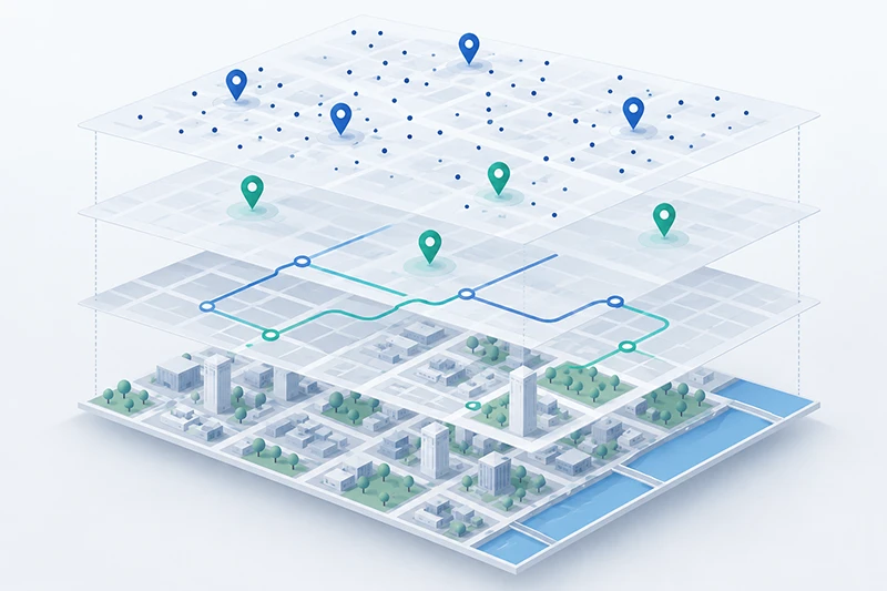
A location intelligence service is a hosted platform that turns raw geographic data - addresses, maps, places, routes, and device signals - into decisions your product can act on. It bundles geocoding, mapping, search, and distance APIs so teams can capture clean addresses, rank on local intent, and route customers to the right store, without building and maintaining that stack in-house.
That definition matters because the phrase gets used two ways. Vendors use "location intelligence" to mean a business-analytics product: dashboards, heat maps, and site-selection reports for analysts. Product and engineering teams use it to mean the API layer that powers a live app: the autocomplete field at checkout, the store locator, the distance-based sort. This guide covers the second meaning - the operational service you integrate - because that is what most product managers are actually shopping for when they type "location intelligence service" into a search bar.
What a location intelligence service actually does
Strip away the marketing and a location intelligence service does four jobs. Each one maps to a concrete moment in your product.
It resolves addresses. A user types "10 downing st" and geocoding returns a validated, structured address with coordinates. Good services return rooftop-level precision where the underlying data supports it, and degrade gracefully to street or locality level where it does not.
It finds and ranks places. Search and autocomplete let a user find a store, a POI, or their own address in one or two keystrokes. This is the difference between a checkout that converts and one that abandons on a mistyped ZIP code.
It measures distance and routes. Distance and matrix APIs answer "which of my 400 stores is nearest, by drive time" and "can this order reach the customer in the promised window." Routing turns a static store list into a click-and-collect flow.
It renders and personalizes. Map rendering displays results; IP-based geolocation can personalize the experience based on a visitor's approximate location - for example, defaulting the store finder to the right country - without asking them to type anything.
The reason to consume these as a service rather than build them is not novelty. It is that address data, map tiles, and POI databases decay constantly and cost real money to keep fresh. A service absorbs that maintenance so your team ships features instead of curating datasets.
Why teams adopt one now (and the consequence of waiting)
Three forces have made "buy" the default answer for most commerce teams in 2026.
First, address quality is now a conversion lever, not a back-office concern. A user who mistypes their address at checkout either abandons the cart or triggers a failed delivery. One-field autocomplete that validates as the user types removes that failure mode. If your competitor has it and you do not, the gap shows up directly in your conversion rate.
Second, local intent search moved from Google's blue links to AI answer engines. Buyers ask an assistant "where can I buy X near me" and expect a direct answer. Structured location data - clean store pages, accurate POIs, machine-readable hours and coordinates - is what makes your business eligible to be that answer. Teams that treat location data as SEO infrastructure rank; teams that treat it as a mapping widget do not.
Third, data governance stopped being optional. The EU's General Data Protection Regulation and the Digital Markets Act both put location and query data under scrutiny. Where your address queries are processed, who can reuse them, and whether they feed an advertising ecosystem are now questions your legal and security teams will ask before a vendor gets signed. A location intelligence service that cannot answer them cleanly becomes a procurement blocker.
The consequence of waiting is rarely a single dramatic failure. It is a slow tax: a few points of checkout conversion lost to bad address capture, a slice of local search visibility ceded to better-structured competitors, and a data-governance review that stalls a launch by a quarter.
The components: what is inside the service
Most services are a suite, not a single API. When you evaluate one, map its components against what your product needs. You rarely need all of them on day one.
Component
What it does
Typical product use
Geocoding / address validation
Turns text into a structured, coordinate-anchored address
Checkout address capture, delivery accuracy
Autocomplete / search
Predicts addresses and places as the user types
Store finder, address field, "search near me"
Maps rendering
Displays interactive or static maps
Store locator, order tracking, coverage maps
Distance / matrix / routing
Computes drive time and nearest-N
Click-and-collect, delivery slotting, store sort
IP geolocation
Approximate location from IP
Country defaulting, currency, regional content
Mobile SDK / geofencing
On-device location triggers
App notifications, dwell-time campaigns
AI / agent integration
Exposes location tools to LLM workflows
In-app assistants, agentic commerce
The last row is newer and worth a note. Some providers now ship a server that speaks the open Model Context Protocol so an AI agent can call geocoding or search directly. If agentic features are on your roadmap, whether the service exposes its APIs to agents cleanly is a real differentiator, not a checkbox.
Build versus buy: the honest version
Engineering teams reflexively ask whether they can build this from open data. The honest answer is: you can build the rendering layer, and you should not build the data layer.
Map rendering on top of OpenStreetMap with open tooling is a solved, legitimate choice - many teams run it in production. What does not work is treating open address and POI data as a substitute for a maintained geocoding service. Address databases require constant reconciliation with postal authorities and local providers; global POI coverage requires licensing and deduplication that a product team cannot staff. The build path quietly becomes a data-curation team you did not budget for.
The pragmatic split most teams land on:
Buy geocoding, autocomplete, and address validation. The data freshness and coverage are the whole value, and they are the hardest to maintain.
Buy or build map rendering, depending on whether you need heavy customization and are willing to own the tile pipeline.
Buy distance and routing unless routing is literally your core product.
If you want a worked technical example of where the build path gets painful, this walkthrough of bulk geocoding addresses in Python shows the batch-processing and rate-limit realities that a hosted service abstracts away.
How to evaluate a location intelligence service
Nine buyers out of ten evaluate on price per 1,000 requests and stop there. That is how teams end up migrating twice. Use these six criteria instead, roughly in priority order for a commerce product.
1. Coverage and precision where you operate. A service that is excellent in North America and thin in your actual markets is worse than a mediocre service that is strong everywhere you sell. Ask for precision by country, not a global average. Premium address data in specific markets (for example, France and the UK) often comes from official local providers and is worth confirming per region.
2. Data governance and reuse terms. Read the terms of service, not the marketing page. Two questions decide most enterprise deals: can you cache and store the results you paid for, and can the provider reuse your query data for its own products? The major platforms disclose in their terms that end-user query data may be used to improve their products, train models, or feed an advertising ecosystem; the exact terms vary by product and should be reviewed by legal before you migrate. A service built for governance will state plainly how request data is handled - for instance, that request data is used only to provide the service, then deleted or anonymized, and is never profiled or resold.
3. Total cost at your real volume and shape. Headline per-request prices hide the real bill. Google Maps Platform, for example, uses per-load map pricing and session-based autocomplete billing, so the same feature costs wildly different amounts depending on how you call it. Model your actual request mix at three scales, not one, and confirm whether free monthly tiers, minimums, and overage rates change the picture. If a comparison looks more than 2x apart, you are almost certainly comparing the wrong SKUs.
4. Migration and lock-in cost. The switching cost is rarely the API swap; it is address-format normalization, re-testing every location-dependent flow, and re-training internal tools. Ask whether the service supports drop-in patterns for the APIs you use today, and budget the format work honestly rather than assuming a "quick" cutover.
5. Reliability and support model. An SLA is a number in a contract; ask what tier it applies to. A 99.9% SLA on the enterprise plan and best-effort on the free tier are two different products. For a checkout-critical dependency, the support model - named contacts, health checks, budget monitoring - matters as much as the uptime figure.
6. Standards and portability. Services that align with open geospatial standards from bodies like the Open Geospatial Consortium are easier to integrate and to leave. Portability is a governance feature: the cheaper it is to switch away, the more leverage you keep.
A quick decision guide
Your situation
Where to start
Checkout abandonment on address entry
Geocoding + autocomplete first; measure conversion delta before expanding
Store network, click-and-collect
Maps rendering + distance/matrix for nearest-store sort
Selling across many countries, GDPR-sensitive
Prioritize governance terms and per-country precision over headline price
Heavy map customization, in-house geo team
Consider open-data rendering; still buy the address data layer
AI assistant or agentic commerce on the roadmap
Confirm agent/MCP integration exists before committing
Where the market stands
The location intelligence market splits into a few recognizable groups. The global incumbents - Google Maps Platform, and to a lesser degree providers like Mapbox, HERE, TomTom, and Azure Maps - offer broad coverage and deep tooling, with the governance and cost trade-offs noted above. Specialist and regional players compete on precision in specific markets, on pricing predictability, or on data governance as a first-class promise.
European retail is a useful lens here because it feels the governance pressure first. Woosmap, the European location intelligence platform behind Woosmap's location layer for commerce, positions on control and conversion rather than on being a cheaper Google: request data is used only to provide the service, then deleted or anonymized, and is never profiled or resold, and its Localities, Distance, and Maps APIs cover the components above. It reports 220+ enterprise clients across retail, logistics, and travel - including publicly listed references such as Decathlon, Leroy Merlin, and Kingfisher. It is one option among several; the point is not which logo you pick but that you evaluate governance and per-market precision, not just the sticker price.
A maps API is one component - map rendering. A location intelligence service is the broader suite that also includes geocoding, address validation, autocomplete, distance and routing, and often IP geolocation and mobile SDKs. You can buy a standalone maps API, but most commerce use cases need the address and search layers more than the map itself.
No, though the phrase is shared. Business-intelligence location tools produce analytics - site-selection reports, heat maps, catchment analysis - for analysts. An operational location intelligence service exposes live APIs that your product calls in real time. This guide covers the operational service; if you need analytics dashboards, that is a different category.
Rarely on day one. Most teams start with the one that maps to their biggest leak - usually geocoding and autocomplete for checkout, or maps plus distance for a store locator - prove the impact, then expand. Buying the full suite before you have a use case for each part is a common way to overspend.
It depends far more on your request mix and volume than on the headline per-1,000 price. Map loads, autocomplete sessions, and place-detail calls are billed differently by each provider, and free monthly tiers change the math at low volume. Model your real usage at several scales rather than trusting a single quoted rate.
Read the terms of service, not the privacy marketing. Confirm whether you can cache and store results, and whether the provider reuses your query data for its own products, models, or ads. Where regulation applies, check where processing happens and how request data is retained. A provider that answers these plainly is easier to get through a security review.
You can build the rendering layer on open data like OpenStreetMap, and many teams do. You should not try to replace maintained geocoding and POI data with open data - the freshness and coverage work becomes a data-curation team you did not plan for. Buy the data layer; build the rendering layer only if you need deep customization.
Next steps
If you are still mapping your requirements, start by identifying which single component maps to your biggest conversion or coverage leak, then read our side-by-side breakdown of the main Google Maps alternatives to see which providers are strong where you operate. When you are ready to weigh specific vendors on governance and per-market precision rather than headline price, that pillar comparison is the fastest way to shortlist two or three to test.
This analysis was written by Jean-Thomas Rouzin, CEO of Woosmap. Jean-Thomas leads a European location intelligence platform serving 220+ enterprise clients across retail, logistics, and travel, processing 28B+ location context calls per year with a 99.9% SLA on the Enterprise plan.