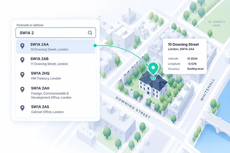
A UK address lookup API turns a partial input - usually a postcode or the first few characters of a street - into a complete, structured UK address, and often into map coordinates. Nearly every serious provider now draws on the same official UK address data, so the accuracy claims look identical on paper. The decision that actually matters is which address model and coordinate precision your use case needs, not which vendor shouts "official data" the loudest.
What a UK address lookup API actually does
The term "address lookup" covers three distinct operations, and most buyers conflate them. Getting the distinction right changes both your integration and your bill.
Postcode lookup. The user enters a full postcode, and the API returns every address registered to it. This is the classic "enter your postcode, pick your address" checkout pattern. It is cheap, predictable, and covers the vast majority of UK residential deliveries.
Address autocomplete (typeahead). The user starts typing anything - a house number, a street, a company name - and the API returns ranked suggestions after each few keystrokes. Autocomplete reduces form abandonment because the user never has to type a full address, but it is more demanding on latency and ranking quality than a simple postcode lookup.
Validation and geocoding. The API confirms that a captured address is real and standardised, and (for geocoding) returns coordinates. This is what you need if you plan to drop a pin on a map, sort results by distance, or route a delivery.
A team that only needs faster checkout can live with postcode lookup. A team building a store locator or a delivery product needs geocoding as well, and that single requirement rules out several UK-specialist providers that return addresses but not usable coordinates.
Why "we use Royal Mail PAF" is table stakes, not a differentiator
Almost every UK address vendor leads with the same line: they use Royal Mail's Postcode Address File. The Postcode Address File (PAF) is the postal delivery database - roughly 30 million UK delivery points, updated daily - and it is genuinely the backbone of UK address capture. But because it is licensed to essentially every provider, "PAF-backed" tells you almost nothing about which API to choose. It is a floor, not a ceiling.
The more useful question is what the provider adds on top of PAF, because PAF has two well-known gaps for anyone doing more than posting letters:
It is a postal dataset, not a property dataset. PAF lists places Royal Mail delivers to. It is not designed to enumerate every physical property, sub-building, commercial unit, or newly built plot that has not yet become a delivery point.
It is postcode-centric, not coordinate-centric. PAF gives you the address text; it does not, on its own, give you a rooftop-accurate coordinate for a map or a routing engine.
That is why the second UK dataset matters.
The two decision axes that actually matter
Once PAF is off the table as a differentiator, two axes separate the options.
Axis 1 - coverage model: postal delivery points vs full property coverage
The alternative to PAF is Ordnance Survey's AddressBase, exposed publicly through the OS Places API. AddressBase is built around the Unique Property Reference Number (UPRN), a persistent identifier for a property, and it includes addresses that are not Royal Mail delivery points - objects such as commercial sites, sub-divided units, and properties earlier in their lifecycle. If your product depends on reaching every property (utilities, surveying, insurance underwriting, local government, new-build sales), UPRN-grade coverage is the requirement, and a PAF-only provider will quietly miss records you care about.
For a standard e-commerce checkout, PAF coverage is usually enough. For anything that must not have blind spots, ask specifically whether the provider blends AddressBase or exposes the UPRN.
Axis 2 - coordinate precision: postcode centroid vs rooftop
If you will ever place the address on a map or measure distance to it, precision is decisive. Many UK lookup services return a coordinate at the postcode centroid - the middle of a postcode area that can span dozens of properties. That is fine for a rough catchment view and useless for "which of my three nearest stores is closest to this exact door." Rooftop-level geocoding, by contrast, resolves to the individual building. When you compare providers, do not accept "we return coordinates" at face value; ask whether those coordinates are postcode-level or rooftop-level, because the gap is often hundreds of metres.
The UK address lookup API landscape in 2026
The market splits into three groups. None is universally best; each fits a different job.
The government dataset. The OS Places API exposes Ordnance Survey's AddressBase directly, with UPRN coverage and coordinates. It is the reference for full-property coverage, and the public sector's own tooling - including HMRC's open-source address-lookup microservice - is built in this world. The trade-off is that you are integrating closer to raw data, with less of the form-facing autocomplete and UX layer that commercial vendors provide.
UK address specialists. Providers such as Loqate, Ideal Postcodes, getAddress, and Postcoder focus on PAF-based capture and validation. Loqate (part of GBG) is a data-quality specialist used more than 70 million times a day across 245+ countries, and it is strongest at validating or cleansing an address after the user has entered it. The specialists are quick to integrate for checkout and are priced per lookup, but their remit is address capture rather than a broader location platform - if you also need maps, distance, or routing, you will be adding another vendor.
Location platforms. APIs such as Woosmap and Google Places bundle address lookup into a wider location toolkit (autocomplete, geocoding, maps, distance). This group is the right fit when address capture is one part of a location feature rather than the whole feature. Woosmap's Localities API, for example, provides UK address autocomplete with premium UK address data from official local data providers, and returns ROOFTOP-level geocoding rather than a postcode centroid - with even stronger precision in the UK while keeping high accuracy in its worldwide coverage. Its autocomplete is free at all volumes, while premium UK addresses are a paid capability on the Pro and Enterprise tiers, billed directly per 1,000 requests with volume tiers. Google Places offers UK addresses through its global dataset and is a natural default for teams already inside Google Maps, though its session-based billing and data-usage terms are worth reading closely before you commit.
How to choose: match the API to your situation
The fastest way to decide is to start from what you are building, not from a feature checklist.
Your situation
What to prioritise
Why it points there
Speed up UK checkout / address entry only
Autocomplete + PAF coverage + low latency
A specialist or a platform autocomplete covers this; UPRN and rooftop coordinates are overkill
Reach every property, incl. new builds and non-postal sites
UPRN / AddressBase coverage
PAF-only providers miss records that are not delivery points
Place pins on a map, sort by distance, or route deliveries
Rooftop-level geocoding, not just address text
Postcode-centroid coordinates are too coarse for door-level decisions
Operate in the UK and other countries
Multi-market coverage under one API
Avoids stitching a UK specialist to a separate international provider
Validate or cleanse addresses already captured
Batch validation and standardisation
A data-quality specialist is built for after-the-fact correction
If two rows apply, the more demanding one wins: needing coordinates or full-property coverage should steer you away from a text-only PAF service, even if checkout speed is your headline goal.
A concrete comparison of the three groups
Criterion
UK specialists (Loqate, Ideal Postcodes, getAddress, Postcoder)
OS Places API
Location platforms (Woosmap, Google)
Underlying dataset
Royal Mail PAF (postal delivery points)
OS AddressBase (UPRN, full property)
Provider datasets from official local data providers; premium UK address data plus global coverage
Coordinate precision
Often postcode-level; varies by product
Coordinate per UPRN
Rooftop-level geocoding available
Non-postal / UPRN coverage
Limited (PAF is postal)
Native (UPRN is the model)
Depends on product; UK premium data adds precision
Multi-country
Mostly UK-focused
UK only
Yes - one API across markets
Typical pricing model
Per lookup
Data licence / per transaction
Per 1,000 requests; Woosmap autocomplete free, UK premium on Pro/Enterprise
Every cell is a capability question you can put directly to a provider during a trial. Treat any answer of "it depends" as a prompt to test with your own addresses before you sign.
A note on address data and privacy
A UK address tied to a named person is personal data under UK data-protection law, and the ICO treats it as such. That has a practical consequence when you pick a provider: the address queries your users type pass through the API, so it is worth asking what happens to that data afterwards. Providers differ. Woosmap, for instance, states that request data is used only to provide the service, then deleted or anonymised; it is never profiled or resold. Whatever provider you shortlist, get the equivalent commitment in writing and have your legal team confirm it fits your obligations - this is a governance question to settle before integration, not after.
Frequently asked questions
It is a service that converts a partial input - typically a postcode or a few typed characters - into a complete, structured UK address, and often into coordinates. It powers the "enter your postcode and pick your address" pattern on checkout and sign-up forms, and it can also validate addresses and return map coordinates for delivery or store-locator features.
For UK residential address capture, PAF coverage is the practical baseline, and nearly every serious provider licenses it. Because it is so widely available, "we use PAF" should not be your deciding factor - it is table stakes. What differentiates providers is what they add: full-property (UPRN) coverage, rooftop-level coordinates, autocomplete quality, and international reach.
Royal Mail's PAF is a postal dataset - it lists the roughly 30 million points Royal Mail delivers to, and it is postcode-centric. Ordnance Survey's AddressBase is a property dataset built around the UPRN, and it includes addresses that are not delivery points, such as commercial sites and new builds. If you must reach every property, AddressBase-grade coverage matters; for standard deliveries, PAF is usually sufficient.
Postcode lookup asks the user for a full postcode, then lists the matching addresses; it is simple and cheap. Autocomplete lets the user type anything and returns ranked suggestions as they go, which reduces form abandonment but demands lower latency and better ranking. Many teams offer postcode lookup as a minimum and add autocomplete where checkout conversion is a priority.
Pricing models vary widely: per lookup, per 1,000 requests, or a data licence. UK-specialist providers typically price per lookup, while platform APIs price per request volume. Woosmap, for example, offers autocomplete free at all volumes and charges for premium UK addresses on its Pro and Enterprise tiers per 1,000 requests; you can size that against your projected volume on its pricing page.
When an address can be linked to an identifiable person, yes - it is personal data under UK data-protection law, and the ICO regulates its use. Choose a provider whose terms clearly state how the address queries your users submit are used and retained, and confirm the arrangement with your own legal team.
Yes, if you choose a location platform with multi-market coverage rather than a UK-only specialist. A single API across markets avoids the cost and complexity of integrating separate providers per country - a real consideration if you are expanding beyond the UK.
Where to go next
Choosing a UK address lookup API comes down to two honest questions: which address model your product needs (postal delivery points or full property coverage), and whether you need rooftop coordinates or just address text. Answer those first, and the vendor shortlist narrows itself - the "official data" marketing stops being decisive.
If you want to understand the UK address and postcode structure your API has to parse, read our UK address guide.
If autocomplete UX is your priority, our address autocomplete overview covers the patterns that reduce checkout abandonment.
When you are ready to size cost against your own volume, the Woosmap pricing page lets you model per-1,000-request pricing with free autocomplete before you commit.
This analysis was written by Jean-Thomas Rouzin, CEO of Woosmap. Jean-Thomas leads a European location intelligence platform serving 220+ enterprise clients across retail, logistics, and travel, processing 28B+ location context calls per year with a 99.9% SLA on the Enterprise plan.