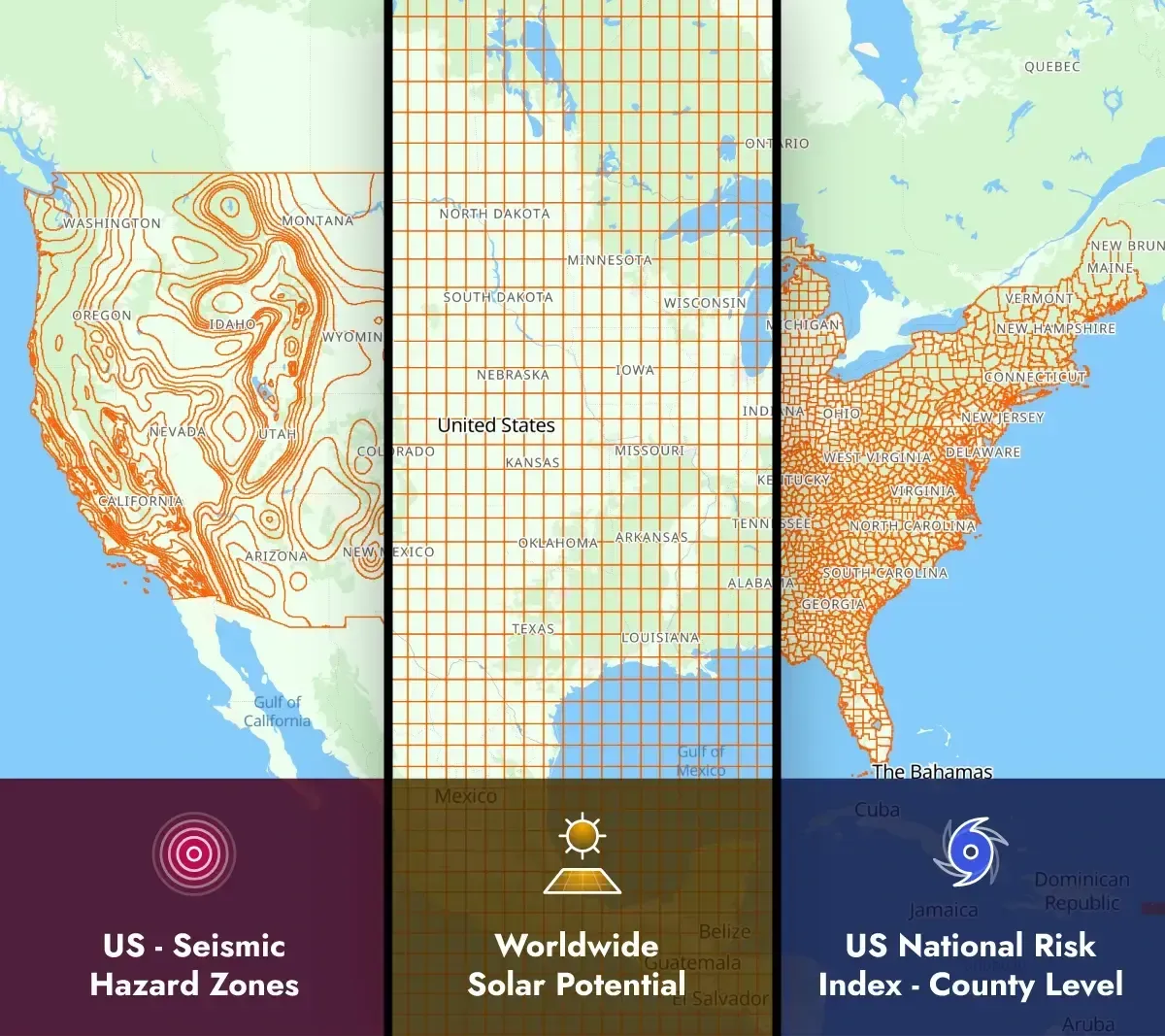
Making Location Data Work for You, Not the Other Way Around
Every day, the choices we make—from the best route home to where we grab a bite to eat—are influenced by location. Geospatial data quietly powers many of our decisions. While these experiences feel seamless to users, the behind-the-scenes process of handling spatial data can be anything but simple.
What if it didn’t have to be so complicated? What if working with location data was as intuitive as the experiences it powers? Enter a smarter way to manage geospatial challenges: tools that simplify the complex and make location data easier to work with. That’s what tools like the Datasets API aim to do, helping you unlock smarter, more efficient ways to host and request complex business data in a simple, manageable way, and build the systems people rely on every day. Let’s explore some of the challenges—and the solutions—that are making geospatial data simpler to use.
The Magic of “Near Me”
There’s something deeply satisfying about discovering what’s close by—whether it’s a cafe, a gas station, or the nearest park. Proximity isn’t just convenient; it’s human. We naturally want to connect with what’s relevant to us in the moment, and proximity-based features bring this connection to life.
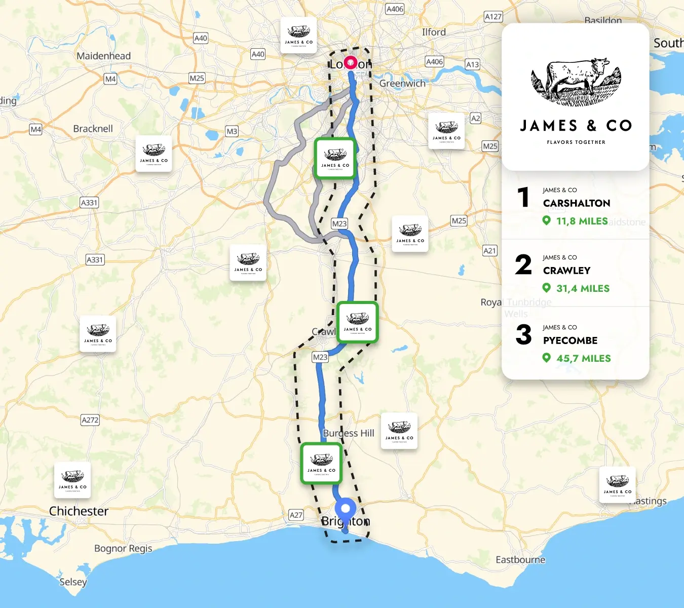
Building these features, however, is where things can get tricky without the right tools. Proximity searches need to be fast, flexible, and reliable. Whether someone’s searching for a point of interest on a road trip or filtering nearby services from a custom input zone, these features need to work every time. Getting it right is about more than just tech—it’s about understanding how people move through the world. The Nearby endpoint, which handles radius-based searches for points, lines, or polygons, helps streamline the creation of these seamless experiences.
Nearby Endpoint: A restaurant brand helping users find locations near their holiday routes for easy trip planning.
Defining the Rules
Every service, delivery zone, or operational area begins with a boundary. These invisible lines define what’s in, what’s out, and what’s possible. But boundaries aren’t always neat. They can shift, and require constant validation.
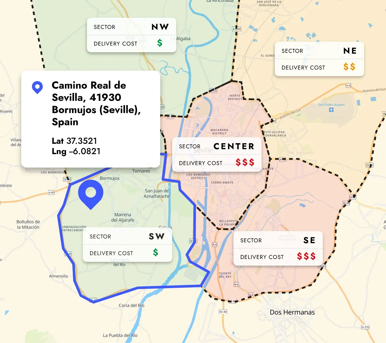
Think about the questions boundaries help answer: Is this address within our service area? Does this route stay within city limits? Are we operating within the right regulatory zones? Tackling these challenges requires clarity, precision, and adaptability. Boundaries aren’t just about drawing lines—they’re about building trust and ensuring smooth operations. The Contains endpoint, designed for queries that check if specific locations fall entirely within predefined regions, simplifies this process and boosts confidence in boundary-based decisions.
Contains Endpoint: A delivery company mapping addresses to assign teams and calculate delivery costs efficiently.
Finding Opportunity in Complexity
Not everything fits neatly into its own space. Routes cross. Territories overlap. Areas of influence blur. While this complexity may seem daunting, it’s often where the most valuable insights are hidden.
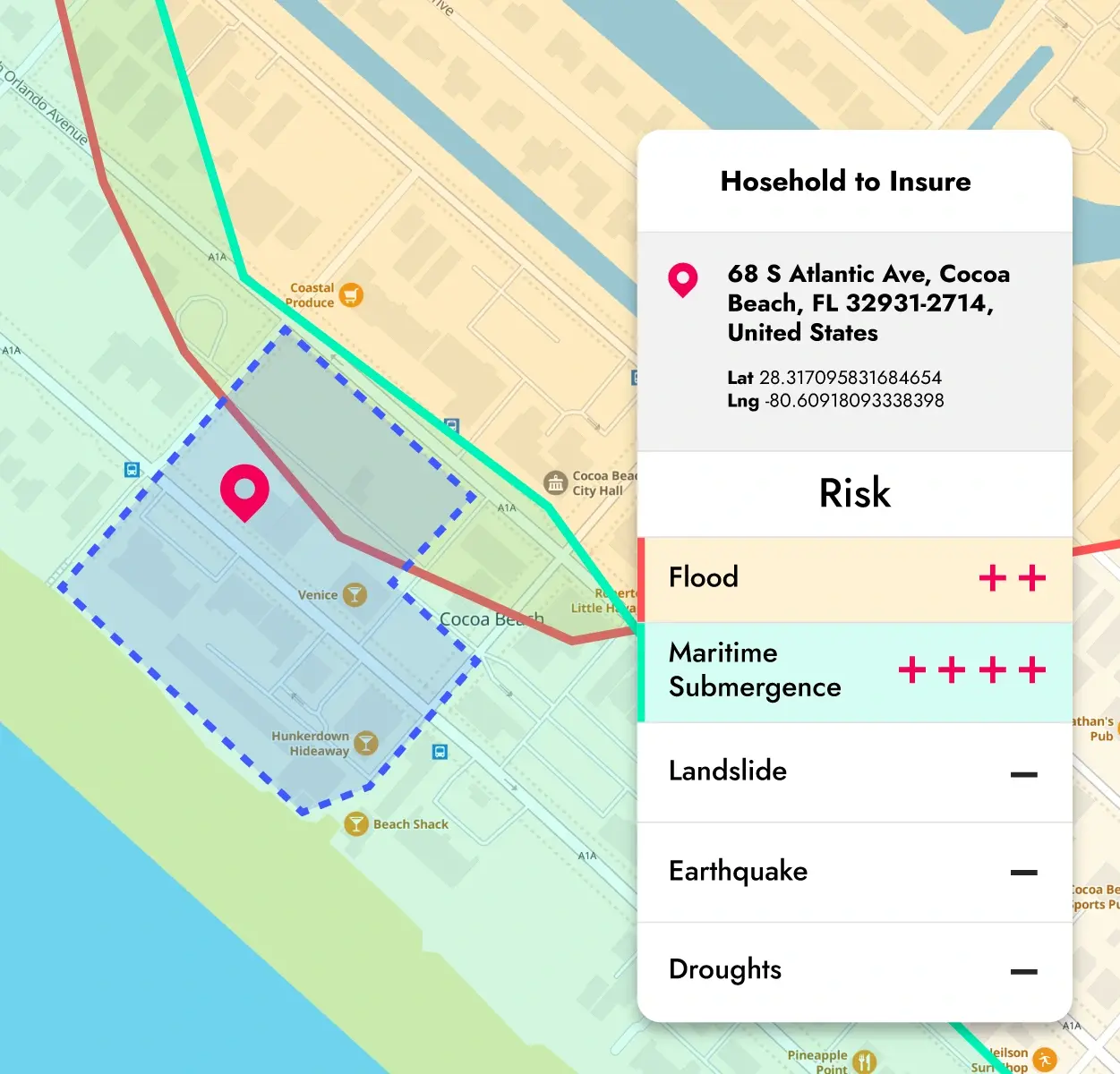
Overlaps reveal shared opportunities and potential conflicts. They help optimize delivery zones, highlight coverage gaps, and pinpoint where paths intersect. Tools like the Intersect endpoint, which identifies and analyzes overlapping geometries, turn these hidden connections into actionable insights.Take a delivery service, for example—overlapping zones could mean you can combine routes to save time and reduce costs. Or for a retailer, identifying overlapping regions can highlight underserved areas where there’s potential for new stores.
Intersects Endpoint: An insurance company identifying risk zones to adjust home insurance quotes instantly.
Staying Inside the Lines
In many cases, precision isn’t just important—it’s essential. Whether you’re dealing with city limits, regulatory zones, or predefined boundaries, it all has to stay in place.
Containment isn’t about limiting options; it’s about ensuring accuracy. It lets planners, developers, and analysts focus on what matters most, without second-guessing their data. By narrowing the scope to what's within a boundary, we make smarter decisions, faster.
Whether it's a real estate developer staying within zoning laws to avoid costly mistakes, or a delivery service ensuring packages reach the right neighborhoods, staying inside the lines saves time, resources, and frustration. Tools like the Within endpoint make sure everything stays where it should. No guesswork, just precise, reliable results every time.
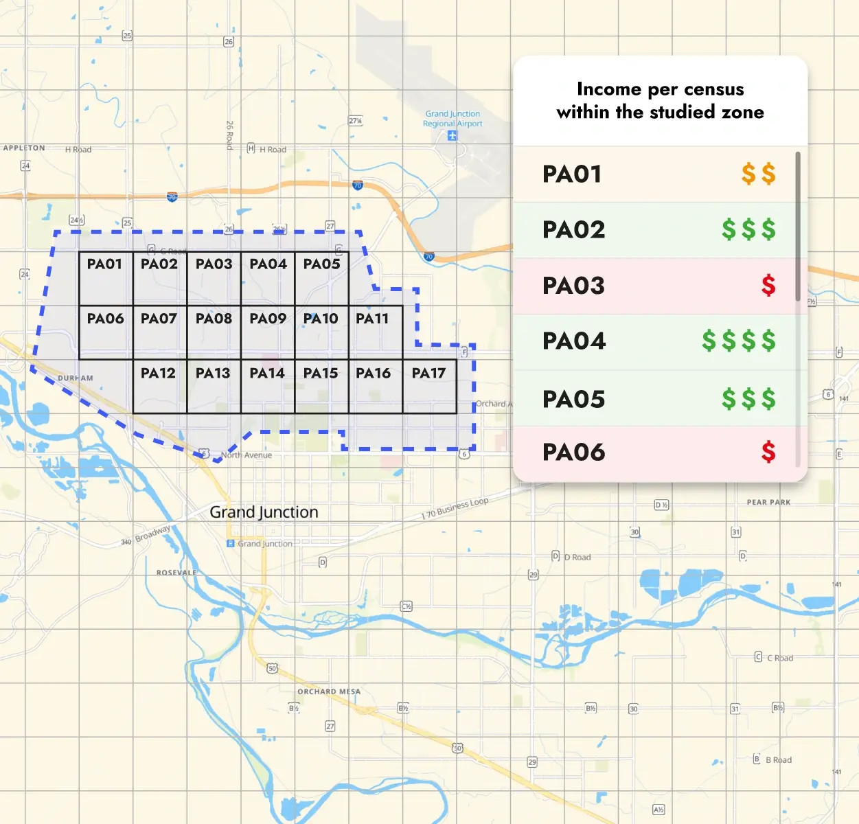
Within Endpoint: A retailer using census data to measure market potential in new settlement areas.
Simplifying the Complex
Geospatial data doesn’t have to be overwhelming. By focusing on the real-world problems we’re solving—whether it’s helping someone find a nearby service or ensuring compliance with regional boundaries—we can strip away the noise and get straight to what matters.
Here’s how Woosmap Datasets can make your life easier:
Built for Developers (and People Who Like Things Simple)
Location data can get messy, especially when tied to developer workflows. Woosmap Datasets integrate seamlessly into your stack. Think APIs and pre-structured data designed to actually help you build things, not bury you under technicalities. Whether you’re coding a location-aware app or running analytics for retail expansion, it’s all there—easy to implement, with thorough documentation to back it up. No need to bring in a GIS specialist—we’ve removed the difficulty to make this API accessible, straightforward, and a real time, energy and resource-saver for you and your team.
Privacy That’s Built In
Here’s the thing: location data can be a double-edged sword. Sure, it’s powerful, but there’s always the question of ethics. We’ve made privacy a priority from the ground up. The Datasets API is designed with privacy compliance ingrained—so you can leverage the power of location data without compromising your business data, or your users’ trust.
Who Is This For?
You might be thinking, "Sounds great, but do I really need this?"
If your work involves:
- Understanding customer geospatial behavior
- Optimizing logistics or operations for smarter routing
- Enhancing apps with hyper-relevant location-based features
- Expanding into new markets with confidence
...then yes, this is for you.
Industry-Specific Examples Include:
- Food Delivery: Analyzing and improving delivery zones to optimize service areas.
- Insurance: Speeding up and enhancing risk zone analysis.
- Real Estate: Identifying high-potential areas and avoiding costly mistakes.
- Retail Expansion: Pinpointing underserved areas and expanding store locations.
- Competitor Analysis: Analyzing market gaps to identify opportunities.
Making Smarter Decisions, Faster
The right dataset can mean the difference between guesswork and insight. Woosmap’s localized data gives you that edge. You’re not just making decisions; you’re making informed ones. Think hyper-accurate delivery zone optimization, risk zone analysis for online insurance, or planning within regulatory boundaries. For food delivery, that might mean analyzing service areas to improve coverage and speed. For insurers, it could mean quickly verifying that policies comply with regional risk criteria. For real estate, it’s identifying high-potential zones and avoiding costly mistakes. It’s about having answers before you even know the questions.
At the end of the day, data isn’t the goal—connection is. Whether it’s optimizing operations for efficiency, ensuring compliance with regulations, or connecting a customer to the nearest service, the right data clears the way.
With Woosmap Datasets API, the focus isn’t on data for data’s sake. It’s about giving you tools that actually make an impact—quietly, smoothly, and powerfully. We’ve done the heavy lifting so you can focus on what really matters: building great things, solving tough problems, and staying ahead of the curve.
So, what do you need to connect? Chances are, the Datasets API has what you’re looking for—or maybe even something you didn’t realize you needed until now.
Discover how in a free exploratory session with one of the Woosmap team here.
Access developer documentation here.
