


Retrieve the latitude and longitude of your own points of interest to position them on a map.
Localities API: Geocoding & Reverse Geocoding
A reliable worldwide geocoding & reverse geocoding engine
A global geocoding dataset in multiple languages that’s both accurate and flexible with full, partial or structured addresses.
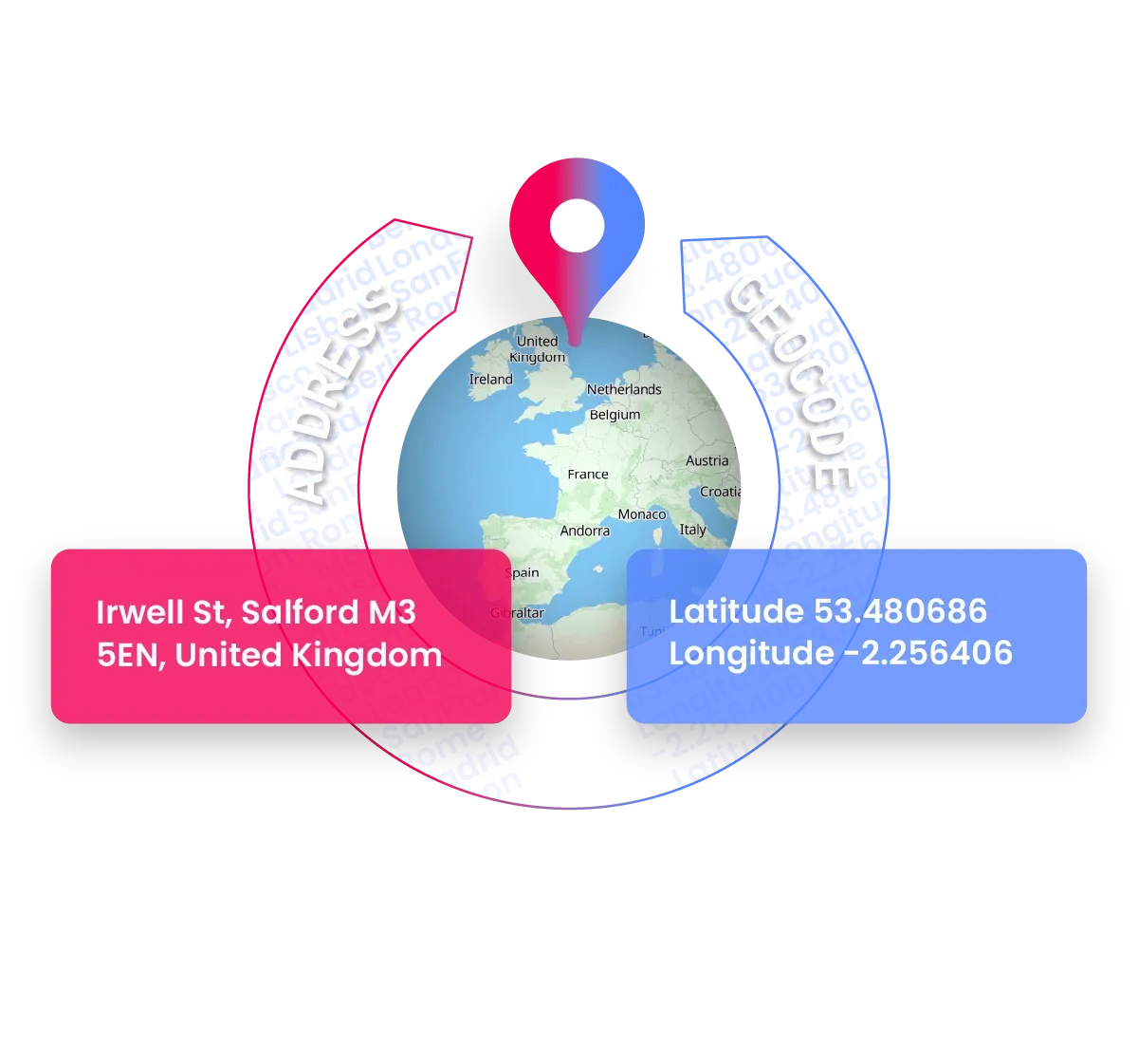
Real-time conversion from latitude and longitude coordinates to address.
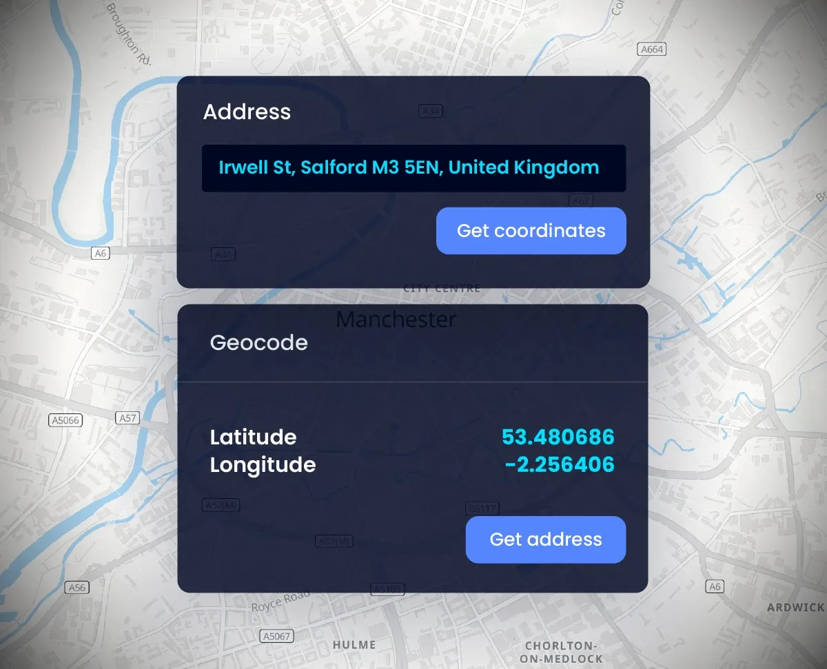
Real-time Geocoding: locate an address and format it correctly
Need to position a postal address on a map or retrieve the positions of your addresses?
Get the exact latitude and longitude of a city, a postcode or a full or partial address, along with its level of accuracy, or retrieve a human-readable address from a latitude and longitude (like GPS coordinates).
You can also retrieve formatted addresses and, in addition, the component parts of an address to fill in your form’s dedicated fields, all in real time.
Trusted by
Worldwide reverse address lookup
The Localities API is an Address Finder API as well as a geocoding API. You can use it worldwide to find addresses from longitude and latitude coordinates.
United Kingdom, France, Canada, US, Germany, Italy, Spain... there is no barrier.
Royal Mail data in UK with Localities API
Woosmap sources the best address data providers (Royal Mail, BAN France) which take the specificities of addresses in these countries into account.
Use cases
Affordable and scalable
Caching policy
Enterprise licences allow caching of latitude and longitude values for 30 consecutive calendar days
Coverage
400 million addresses in over 243 countries and territories.
Performance
Hundreds of millions of geocoding requests with response times between 10 and 100 ms.
FAQ
What is geocoding?
Geocoding is the conversion from an address to geographical coordinates in latitude and longitude (lat/long).
These coordinates can then be used to map the results, compute distance calculations to find closest locations and even get directions to those locations. For example, King’s Cross Station, Euston Rd., London N1C 4TB, United-Kingdom correspond to 51.531761, -0.123621
On one hand, Geocoding is something which we use all the time when accessing mapping services. When opening a map application and choosing a position on it, visually representing a location with the “blue dot”, the process is called geocoding.
On the other hand, when someone is sharing their live location, the blue dot can also be use for reverse geocoding.
Note: whether there’s a full or partial address, Geocoding API can recognise anything.
What is Reverse Geocoding?
Reverse geocoding, also called reverse address lookup, is geographical coordinates (longitude and latitude) matched with the nearest address (or street). For example, 55.948598, -3.199923 are the geographic data coordinates that will match Edinbrugh Castle, Castlehill, Edinburgh EH1 2NG, United-Kingdom.
Where does it work?
Geocoding and reverse geocoding have a worldwide coverage with the exception of the following countries: China mainland, North and South Korea, and Japan.
Note: Woosmap provides the best data in France and the UK!
How can I optimise geocoding results?
You can use filters by country or language to get more relevant results.
Use the “language” setting to limit the number of results or filter by country (alpha 2/alpha 3 codes are available) to restrict your results to specific areas.
Use different parameter to narrow down your results:
- Define countries or geographical parameters in your requests to limit results accordingly.
- Specify the language parameter to get results in a dedicated language (when available).
Check our documentation to get more details.
Can I perform bulk geocoding (batch process) with your Geocoding API?
Yes, the REST API is designed to support a large volume of requests (possibility to do batches). You can use the API to properly format your clients’ address database, for example.
If you intend to cache results, please contact us to get details on caching options
How much cost the API?
Woosmap operates on subscriptions.
The Woosmap Console account will pool the volume of queries made in all the APIs set up on your platform. The subscription will depend on the volume of queries available.
Credits are counted each time a query is made to a Woosmap API. Though, not every query is worth the same, it ranges from 0.1 to 5 credits per query.
You can check pricing here.